ФОТО: petapixel.com
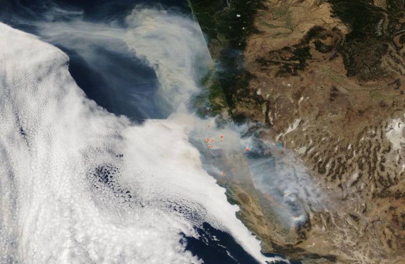
Here’s an eye-opening satellite photo captured by NASA showing the wildfires and smoke “dominating” the landscape of the western United States. NASA’s Aqua captured the visible (left) and infrared (right) images on September 29th.
The visible imagery shows the widespread smoke blanketing much of California, while the infrared imagery shows heat from the wildfires as […]. petapixel.com
2020-10-6 23:13